GOCE gravity mission back in action.
ESA's GOCE gravity mission has recovered from a glitch that prevented the satellite from sending its flow of scientific data to the ground. News of the recovery comes earlier than expected, thanks to the fervent efforts of a team of experts.
The recovery follows a serious communications malfunction on 8 July, when the Gravity field and steady-state Ocean Circulation Explorer (GOCE) satellite suddenly failed to downlink scientific data to its receiving stations.
Extensive investigations by experts from ESA and industry revealed that the issue was almost certainly related to a communication link between the processor module and the telemetry modules of the main computer. These telemetry modules are situated between the processor board and the transmitters, forming a vital part of the onboard data handling and communications system.
Recovery from the situation came after software patches gained access to troubleshooting information via the slow trickle of data that was still reaching the GOCE ground stations. This new information allowed the team to develop an understanding of the state of all the onboard systems. As part of the action plan, the temperature of the floor hosting the computers was raised by some 7°C – resulting in restoration of normal communications.
Plans are in place should the communications system experience the same glitch in the future. Software patches are now being developed to allow the two onboard computers to work in unison.
Volker Liebig, Director of ESA's Earth Observation Programmes, said, "We are very glad that one of the most innovative missions of ESA is back on track. I would like to congratulate and thank the teams from ESA and especially industry".
"I often get questions from journalists as to whether ESA satellites are not over-designed, with their redundancies and long lifetimes. This case shows how important it is to have these margins in case of problems. Consequently, we can now deliver scientists the full scientific programme."
The issue is not the first hiccup that GOCE has experienced since its launch in March 2009. In February 2010, a chip problem in the main computer meant that operators had to switch over to the satellite's backup computer system. There is, however, at present no evidence of any relationship between the two problems that have affected GOCE.
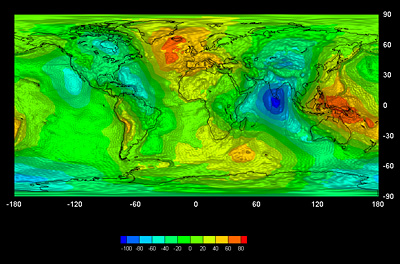
Orbiting through the outer remnants of Earth's atmosphere to sense the strongest gravity signal possible, GOCE is the most advanced gravity mission to date, designed to map variations in Earth's gravity field with extreme detail and accuracy.
Since becoming operational in September 2009, GOCE has already delivered two-thirds of the gravity data expected from the mission. Consequently, scientists worldwide already have a huge and immensely valuable dataset that will redefine our understanding of Earth's gravity field.
Moreover, with GOCE having regained its full capacity, it is hoped to continue the mission far beyond the end of the designated lifetime in 2011 – the satellite operations have, so far, required much less fuel than expected.
Rune Floberghagen, ESA's GOCE Mission Manager, said, "On 6 September the main instrument, the gradiometer, which measures the spatial variations in the gravity field in extreme detail, has also been switched on and shown to be fully functional.
"With everything back in proper working order, the satellite is now being gently brought back down to its operational status and altitude. This should be achieved before the end of September."
Source.


")
